![]()
![]()
Seltzer Summit
Louis A. Seltzer County Park, Lakeside, CA
GC73F, June 25, 2001
Just off Wildcat Canyon Road in Lakeside, this little park has a lot to offer, including two or three miles of nice hiking trails, a kids play area & picnic areas. When you get to the top, there are some good views and plenty of places to sit on a smooth boulder and contemplate the meaning of life. It's a short easy hike except the two hundred yards just below the ridge.

There is about a 900' elevation gain, so you'll get a little exercise. As you can see by my GPS track above, I tried to hike every trail in the park, some of which are dead ends.


The park is big on signs and facilities. The photo on the right shows the Ridge Trail with oak trees.
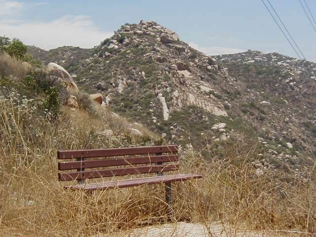

On the left is the bench at Kumeyaay Promontory with Seltzer Summit in the background. On the right is the Summit from the trail.

This is the steep part of the trail. The sign says "Steep and slippery - Hike at your own risk". It wasn't all that steep but because of a lot of loose gravel, it was a little slippery coming down.


On the left is the Summit from the trail to the north. In the middle are rocks at the Summit and on the right is the cracked boulder which is referred to on the cache page. Way down below is the parking lot and just below is the rock under which the cache is hidden.


On the left is the cache in its resting place. In the middle is Stork with the cache and on the right is the cache on the rock ledge on which I sat for a while and contemplated the meaning of life as well as read a few pages from the 1997 World Almanac which was in the cache. This was a nice easy-to-find cache.


A couple views from the top: looking southwest and looking northerly up Wildcat Canyon.